⟵ BACK TO Green Harbors

Boston Harbor

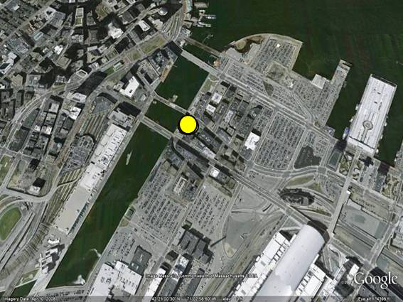
Having been initiated in Boston, the Green Harbors Project’s (GHP) vision encompasses the stewardship of the water flowing from the upland watersheds to through the harbor and out to Stellwagen Bank.  Using a whole system approach, the sites on the map (below) follow the course of the rivers, the coastal salt marshes and water quality within the harbor itself.


The GHP restoration efforts strive to recognize and incorporate the traditional ecological knowledge of native communities, both locally and globally. This approach has included our participation in the building of an educational fish weir on Thompson Island in the spring of 2010. Thompson Island was historically a summer fishing site for local native communities and is a convergence point for three main rivers: the Neponset, the Charles and the Mystic Rivers.

Traditional ecological knowledge (TEK) is a holistic set of observations, stories and traditions that are passed along from generation to generation. One primary aim of TEK is to maximize the sustainability of local resources; and this is exactly what Dr. Frankic wanted to mimic when initiating the GHP. She envisioned the establishment of a holistic scientific approach when working to restore shellfish, salt marsh and eelgrass beds.

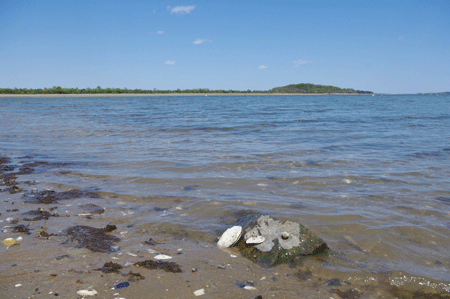
Presently, UMass Boston and the GHP have several research and community-oriented projects underway with more and more momentum being built in their wake. Our projects include salt marsh monitoring and restoration, monitoring of invasive species, monitoring harbor water quality, native shellfish restoration, green roofs development and the pumping out commercial boaters.

Please join us as we re-imagine a harbor teeming with lobster, boaters, swimmers, eelgrass, and native shellfish.

Boston Current Projects

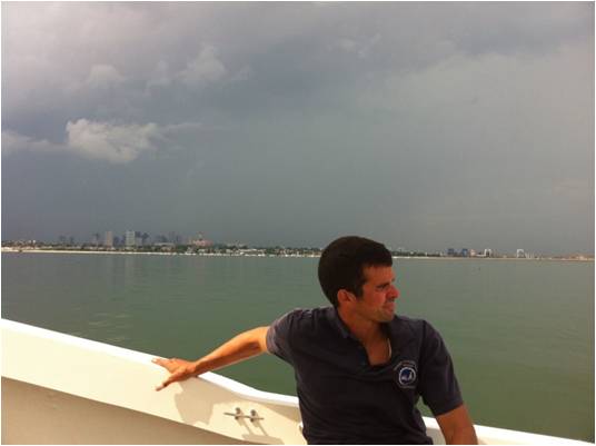
We are excited to share our current work in the Boston Harbor with you, including the possibility for restoring some of the harbor's lost and degraded coastal habitats through the Biomimicry LivingLabs.


Students are the key to the GHP's success, as many of these projects are student-led. The student projects address local community issues and positively contribute to student employments post-graduation, they are all presented in the accompanying pages.

We welcome and strongly encourage community and organizational support for the student’s work.  If you would like to learn more, please visit our Adopt-a-Student for a green job page.

Fort Point

The Green Boston Harbor Project (GBH) and SHIFTBoston are convening a multi-disciplinary team to design and implement a biomimetic strategy to improve the environmental conditions of Boston's Fort Point Channel by establishing a floating wetland system.  Wetlands provide essential ecological services for the harbor, including improving water quality, providing habitat for a variety of fish and shellfish during at least part of their lives, and protecting the shoreline from storm surges.  

Floating wetlands offer opportunities to restore these services when shoreline access is limited by development or other causes. The project will use a biomimicry approach, applying lessons learned from healthy wetland systems so the floating wetlands will become self-sustaining and thrive for the long term.

The project is likely to first become an exhibition and then perhaps implemented.


Background: Download Draft proposal for shellfish restoration at Fort Point Channel and for the larger harbor

Photos: Floating wetland http://www.floatingislandinternational.com/gallery/; Fort Point Channel Google earth


Malibu Bay

Malibu Bay/Savin Hill Beach is a small bay located just a few minutes south of the UMass Boston campus.  It is a microcosm of Boston Harbor with boats, dog walkers, swimmers, and fishermen and women sharing the beach and bay with the inhabitants of the salt marsh and mud flat ecosystem. This project is a Biomimicry LivingLabs experiment promoting and linking the ecological stewardship between the local community and students. The goal of this stewardship is to find solutions for the question: how can we adapt and care for both the people and natural community in a long-term approach?

Students: Lisa Greber, Julia Frederick, Nicoletta Vianella, Alexander Etkind, Meredith Eustis, Patty Slattery

This project began in the summer of 2009 until 2013. It has assessed both the ecology of the bay and needs of local residents to see how people and ecology can best work together in a small area. The assessments to date have included an intertidal biodiversity survey, transect studies of existing salt marsh and the analysis of water and sediment quality.

We also asked the community to share their stories, including their reasons for visiting the beach, their knowledge of some of its ecology and their vision for its future.

At Malibu Bay, we are celebrating as well as doing science. GHP students participated in a beach cleanup, campfire and community meetings. We also participated in the second annual Malibu Beach Festival, sharing pictures of native plants, mud snails, snowy egret and invasive tunicates with children and adults alike. At the festival we collected people’s visions for a green Boston Harbor: cleaner water for swimming; boat rentals on the beach; more fish to come back in the harbor and beyond.

Photo credits: Malibu Beach cord grass (Spartina alterniflora): M. Eustis.

Savin Hill Cove

Biomimicry LivingLabs received $100K grant from the Schmidt Family Foundation!

Boston Water and Sewer Commission Water Quality Monitoring at Morrissey Blvd. Drainage Conduit Project (Executive summary)

GHP students and Dr. Anamarija Frankic have been working with students from Newton High School and Outward Bound from Thompson Island on salt marsh restoration in Savin Hill Cove, adjacent to the UMass Boston campus.  On Saturday, Sept. 24, 2011 at low tide, we came to the site to measure basic water quality in the intertidal area with fringing salt marsh, and found 156 oysters throughout the Cove.

Please note that this area is contaminated and closed to shellfishing. All shellfishing is prohibited.

The oysters were both European oysters (Ostrea edulis) and native Eastern Oysters (Crassostrea virginica). From their sizes, we estimate the oysters ranged from 6 months to 5-6 years old.  Finding young oyster specimens attached to stones and blue mussels suggests these oysters were here for at least from 2010 year's spawning.  The oysters were found in areas where ground water is seeping out into the cove creating small channels, where substrate (bottom) is firmer and lacks accumulation of silt and mud, therefore providing more suitable conditions for oysters attache as spats and to survive.

Presently, we have established and begun testing how the presence of afloating island can help buffer the shoreline and improve water quality. Floating islands are made of a non-toxic PET plastic matrix that has holes for plants to grow on/in. We are in the early monitoring phases with the island and come springtime, we plan to plant Spartina spp. and monitor its impacts on the area.

EEOS 476 Fall 2013 SyllabusStudent Projects 

"Assessment of policy conditions, constraints, and consequences in the process of shellfish restoration: the complex permitting process for restoration of urban harbors" (Paper PDF)(Presentation PDF)

"Development of sustainable solutions to mitigate sediment and contaminant re-suspension during storm surge and tidal inundation in urban harbor (Savin Hill Cove)" (Paper PDF)(Presentation PDF)

"Assessment of existing fish advisories in Boston Harbor and comparison between three urban estuaries: Neponset, Charles and Mystic Rivers" (Paper PDF)(Presentation PDF)

"Shifting Shorelines of Savin Hill Cove(GIS Landuse/Landcover mapping)" (Presentation PDF)

"Environmental assessment of the Cove: historical changes inlocal biodiversity"

"Evaluation of essential fish and shellfish habitats (ESH) and how will sea level rise scenarios and changing climate impact the ESH in the Cove"

"Assessment of potential human health impacts from present water quality in the Cove"

"Using Floating islands to help restore ecological services in urban harbors through biomimicry-based design and engineering"

"Using the Biomimicry LivingLabs to strengthen campus-community interactions in addressing environmental issues in the Savin Hill Cove"

"Assessing local businesses, technologies, innovative environmental solutions and inviting them to showcase their products at the Biomimicry LivingLabs"

"Develop social media communication for outreach and education about the Biomimicry LivingLabs and the Student Capstone Projects"

Dr. Anamarija Frankic and Stephen Norris,  May 2014 presentation for the Savin HIll local community  Biomimicry LivingLabs.

Boston University student Ashley Jones' wrote an article about the Biomimicry LivingLabs.

For background information about the Cove, view previous student capstone projects: Savin Hill restoration and Savin Hill dredging.

Click here for water quality data from the MWRA (Massachusetts Water Resources Authority) (Savin Hill Cove is Station 39).

Visit the Savin Hill Yacht Club

Squantum / Moon Island

Moon Island, home to native oysters, local shellfish and salt marsh, also has a long history of human use from pre-colonial times to the present. Moswetuset Hummock, in nearby Squantum (Quincy, MA), was the seat of Native American chief Chickatawbut in the 1600s (student historical fiction).  During the colonial era, the island served as a farm, most notably under the tenure of Lillie Titus, the island's owner in the mid and late 1800s. 

In more recent years the Island was used as one of two terminuses of Boston's sewage system, where all the waste from the south part of Boston area was piped to the Moon Island and released into the Quincy Harbor with tides.  This represented a state of the art facility in the 1890s, but not in the 1970s when it was closed.  Althoughpart of Quincy and its jurisdiction in Norfolk County, the island is currently managed by the City of Boston as training facilities for the fire and police departments, including an open firing range.

The SQUANTUM COMMUNITY ASSOCIATION / FOCUS GROUP: RESTORE (Residents for environmental stewardship to restore earth ) is working with local communities and elected officials to prevent further contamination of the island from oil, bullet shells/lead, clear cutting, and other hazards associated with the training facilities, with a goal to restore the island and surrounding area to its former ecological health.  Please see the documents and links below, prepared by RESTORE, for more information about Moon Island History, and environmental issues.

Current RESTORE Environmental Work

Memorandum Letter for Quincy Conservation Commission

Moon Island handout for Conservation Commission Meeting

Supplemental photographs for Conservation Commission Meeting

For more information, please contact:

SQUANTUM COMMUNITY ASSOCIATION FOCUS GROUP RESTORE
Residents for Environmental Stewardship to Restore Earth (RESTORE)
Learning and Living Environmental Justice
Address: RESTORE
                 Squantum Community Association
                 136 Standish Road
                 Quincy, MA 02171-1140
Telephone:  617-376-1361

Contacts: (alphabetically)
Faye Anderson
Melissa Beesley
Ana Frankic
Louise Grabowski
Jim Stamos
Marie Stamos

Boston Harbor Past Projects

These past projects detail some of our earlier work in the Boston Harbor, including helping to create an outdoor classroom at the nearby Mather Elementary School,  planning for restoration at the Old Harbor site on the campus border, and a student vision for the UMass Master Plan.

Green Roofs

Project Leader: Steven Von Fleck

Green roofs can help protect the harbor both by retaining rain water and by reducing energy use for heating and cooling.   Undergraduate student Steven Von Fleck shares his insights on their history and current use - and some fabulous photographs - in this independent research project.

Outdoor Classroom at the Mather Elementary School

Original Schoolyard Initiative Proposal  
Current Mather Schoolyard Proposed Design

Mather Elementary School (K-5), the first public elementary school in the USA (1635), has  the most beautiful ‘top of the Hill’ position overlooking Dorchester Bay and Boston Harbor.

The schoolyard project will strengthen the collaboration between families, local community partners and neighbors, and prove that vision and hard work make changes.

In order to recognize the complexity of our community from all over the world, we count on volunteers to contribute good planting strategies and demonstrate traditional small farming practices from their countries in the designated part of the future school yard landscape. An important part of the project is to select indigenousplants and  trees of the Dorchester area, and the Dorchester Historical Society members will serve as horticultural consultants to help
in this task. 

Our community partner, Dr. Anamarija Frankic, has presented the possibility of creating a ‘LivingLab classroom’ as part of the school yard landscape that will present the connection between the school environment and the nearby coastal environments (Malibu Beach and Dorchester Bay). This outdoor classroom will be a small educational site for kids to learn about the relationship between the people and the watershed where we live. This approach will not only beautify the landscaping of the school yard, but also teach children why to choose certain plants and trees, where to plant them, and the importance of water and the ocean in our lives.

Old Harbor Restoration

Project lead: Mike Riccio (MS 2011)

Salt marsh and eelgrass habitats provide important ecological services such as filtering water, increasing nutrient cycling, providing habitats, and improving the trophic structure. These ecosystems and their services are typically overlooked in urban settings or are impaired due to coastal development. We propose to restore these habitats on an approximately two-acre site on Old Harbor at the University of Massachusetts Boston (UMass Boston). 

Download Mike Riccio MS thesis

Download draft proposal

Goals of the project include minimizing erosion, mitigating degraded coastal ecosystems in Boston Harbor, developing a protocol for biomimicry-based habitat restoration, repopulating native shellfish, and restoring connectivity between salt marsh and eelgrass habitats. The project will have positive environmental impacts by reopening the hydraulic connection between the salt marsh/pond/channel and ocean, thus providing diurnal flushing, as well as by establishing natural buffers with mudflats, eelgrass, and salt marsh vegetation. Additionally, restoring eelgrass beds and oyster reefs will help to stabilize sediment, and increase biodiversity.  We are using the biomimicry-based habitat restoration approach to contribute to adaptation and mitigation responses to global climate change, sea level rise, and water inundation.

Presently this area—between an old wastewater pump house and Old Harbor—experiences severe erosion and subsidence. As part of the Boston HarborWalk, this area presents a danger for pedestrians. We propose that this particular section of the HarborWalk be supported by a raised wooden walkway, weaving around the restored salt marsh. This site would become the first “living lab” on campus, allowing students, community members, and researchers to have hands-on experiences in these ecosystems; this would include conducting short-term research and long-term monitoring on the re-establishment of salt marsh and eelgrass habitats, their associated communities, and related environmental parameters. This project’s vision of biomimicry-based habitat restoration is one example of learning how to solve our current environmental issues by ensuring that human systems function more like the natural world.

UMass Master Plan - Student Vision

Project Leaders:

Grant Emde
Anna Hines
Jaqueline Spade
Ekatherina Wagenknecht

Students from Anamarija Frankic's Coastal Zone Management class developed a comprehensive vision for a sustainable UMass Boston harbor campus, including LEED certified building materials, green roofs, landscaping, energy conservation and production.  They have presented their vision in a variety of venues, including to fellow undergraduate and graduate students, the Master Plan Steering Committee, and the architects of the campus master plan. 

Download students' vision here

Urban Harbor Salt Marsh Restoration

Project leader Timothy Maguire (M.S. 2012)

Development of a Salt Marsh Restoration Site Selection Method for Urban Harbors

My assertion is that currentsalt marsh restoration is focused on large tidal flow restoration projects.  Tidal flow restoration projects are generally projects where a physical barrier to the sea is removed changing the salinity of a freshwater embayment.  These projects are the primary means of restoration because they have a high “bang for the buck.”  These projects have a high return on investment in terms of monetary investment to acreage restored. 

In urban harbors the mainstream salt marsh restoration focus on tidal flow restoration is not a valid paradigm.  Urban harbors such as Boston cannot be truly “restored” to their original salt marsh as a majority of the current Boston coast line is artificial.  The anthropomorphic coast has been created by filling in bays, estuaries, and low lying areas that surrounded Boston’s original skinny peninsula.  Additionally, the current coast is mostly developed all the way to the upland edge of the intertidal systems which, eliminates the possibility of undeveloped freshwater systems existing that require reintegration with the sea.  I propose that while urban harbors do not fit into the normal assumptions of salt marsh restoration they are none the less important and deserving of revitalization.

For my thesis research I:

·         Interviewed salt marsh restoration professionals to confirm that the “bang for the buck” paradigm asserted above is accurate

·         Identified possible sites for urban harbor salt marsh enhancement in Boston

·         Reviewed archival information on these possible sites and develop a comprehensive site model

·         Took physical measurements of publicly accessible sites for slope, salinity, pH, and current salt marsh coverage

Based on the results a proposed four step unique method was developed and discussed.

Water-Energy Nexus

Project Leader: Seth Sheldon  (PhD 2012)

A Model to Relate Environmental Variation to NPDES Permit Violations at Thermoelectric Facilities on the Taunton River

Abstract

Large thermoelectric facilities are issued permits to discharge high volume, high temperature effluents as part of the National Pollutant Discharge Elimination System (NPDES). Once-through cooled power plants are especially dependent on large quantities of cool water to operate. When ambient temperatures are high or streamflow is very low, power plant managers must reduce (i.e., "dial back") energy generation in order to avoid violating their NPDES permit limitations. Sudden dial-back can have human health impacts when electricity is no longer available to provide cooling or other vital services. A superior system of electricity and environmental management would reduce the probability of future violations and/or dial-back by explicitly recognizing the facilities for which those events are highly likely. An original statistical model is presented and used to answer the following research questions: 1) Do electricity demand and natural environmental conditions influence withdrawal rates and effluent temperatures at once-through thermoelectric facilities? 2) Is it possible to estimate past withdrawal rates and effluent temperatures where reported observations are unavailable? 3) In the future, how often will power plant managers face the decision to dial-back generation or violate their plant's discharge permit? 5) What can be done to avoid such decisions and the resulting negative impacts? Two facilities in Massachusetts were chosen as representative case studies. Using public records, several decades of daily and monthly observations of environmental variables (e.g. ambient air temperature, streamflow) and monthly energy generation were tested against monthly observations of facility water withdrawal rates and maximum discharge temperatures using a multiple linear regression (MLR) approach. The MLR model successfully estimated monthly maximum discharge temperatures for both facilities using monthly average of daily high air temperatures and monthly net electricity generation. The model was used to identify months in the past when violations or dial-back are likely to have occurred, as well as months in the future when each plant is expected to dial-back or violate its permit as ambient air temperatures continue to rise. Solutions are presented that reduce the number of predicted violations, meet consumer electricity demand to the greatest extent possible, and reduce the chances of sudden dial-back.

Collaborators:

Massachusetts Executive Office of Energy and Environmental Affairs (EEA), Massachusetts Department of Energy Resources (DOER), Massachusetts Department of Environmental Protection (DEP), Massachusetts Clean Energy Center (CEC), Massachusetts Geographic Information System (MassGIS), University of Massachusetts Boston GIS (UMass GIS), University of Massachusetts Boston Venture Development Center (UMass VDC)

Relevant Legislative Mandates:

Energy Policy Act of 2005 (§127, 170E, 902, 911, 971, 979)
American Recovery and Reinvestment Act of 2009 (Title IV)
Proposed American Clean Energy and Security Bill (§213, 242, 701(a)1.3F-H, 705(c)4B, 422(b)4, 464(b)1C)
Massachusetts Green Jobs Act (§2(a) iii,vi,x,xi)
Massachusetts Green Communities Act (§7, 11, 32)
Massachusetts Energy Bill (§2, 11, 23, 32, 89, 108, 116)
Massachusetts Global Warming Solutions Act (§2(c-f), (h), 4(b)3, 9C(b),

Water Quality/Marine Invasive Species

Project Lead: Chris McIntyre (M.S. 2012)

The Fouling Community of Boston Harbor: An Assessment of Marine Invasive Species, Water Quality and Biodiversity
Marine invasive species represent a major portion of the Boston Harbor fouling community, causing significant environmental and economic impacts. Characterized by tolerance to pollution and aggressive colonization, these invaders pose potential threats to native species through competition for resources and possibly predation.  Invasive species cause drastic alterations to ecosystems and communities and are considered by many biologists to be one of the most significant threats to local and global biodiversity.

Attempts to control biological invasions in the marine environment have been unsuccessful. Recent studies have linked increased invasibility to factors ranging from introduced artificial substrate, urban development, water pollution and depressed native biodiversity. My project supported the efforts of the Green Boston Harbor Project (GBHP) to monitor invasive species in Boston Harbor. The goal of the project was to expand the current understanding of marine invasive species tolerance to variations in water quality parameters and to improve efforts to prevent and control further introductions.

Four project sites were used to study variations in water quality and invasive species using settlement plates in an effort to demonstrate that water quality variations within a single commercial port will result in consistent differences in diversity and abundance of marine invasive macroinvertebrates with local fouling communities. Aluminum fouling plates were installed on floating docks at four selected study sites within Boston Harbor; each site displayed varying degrees of ecological impairment based on nutrient levels, bacteria counts, physical parameters including dissolved oxygen, temperature, salinity and pH as well as anthropogenic disturbances including the total area of floating dock area (m2) within a 300 meter radius of the study site and the estimated number of vessels visiting the site per day. At each site, fouling plates deployed at 1 and 2 meters were used to assess larval recruitment rates every two weeks. Photographs were during site visits for assessment of percent coverage overtime. Biomass samples were taken at the end of study period in late September. Biodiversity of each site was calculated using data collected in each of three assessment methods.

Canonical Correspondence Analysis (CCA) was the statistical method used to analyze the data and further the understanding of species relationships to environmental factors. The results suggest there is a strong correlation among the presence of the invasive species studied with nutrients, turbidity and anthropogenic disturbances.